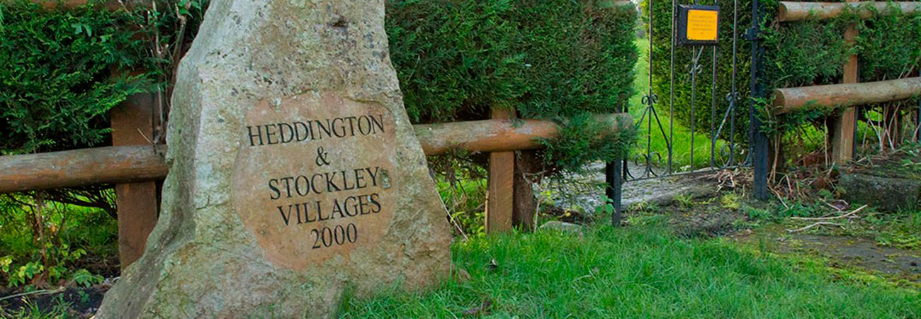

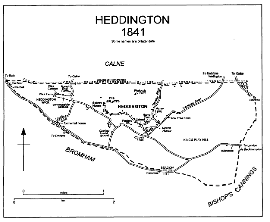
Heddington and Surrounds
Whether you are walking, cycling or riding, there are many interesting routes and landmarks within easy reach of The Ivy Inn.
Heddington and the surrounding area has a very rich history, with evidence of human activity from the Neolithic Age, the Iron Age and the Celtic Age, including barrows on Kings Play Hill and near the Celtic hillfort now known as Oliver’s Castle. A prominent Roman road passed nearby, as does the Wansdyke defensive bank which was probably constructed in the 6th Century.
Local place names, including Heddington, Stockley and Whetham, have Saxon origins and nearby Chippenham was a stronghold for King Alfred for many years in his struggles against the Danes—whom he eventually defeated at the Battle of Edington (or, more precisely, Bratton)—a site that is visible from Oliver’s Castle.
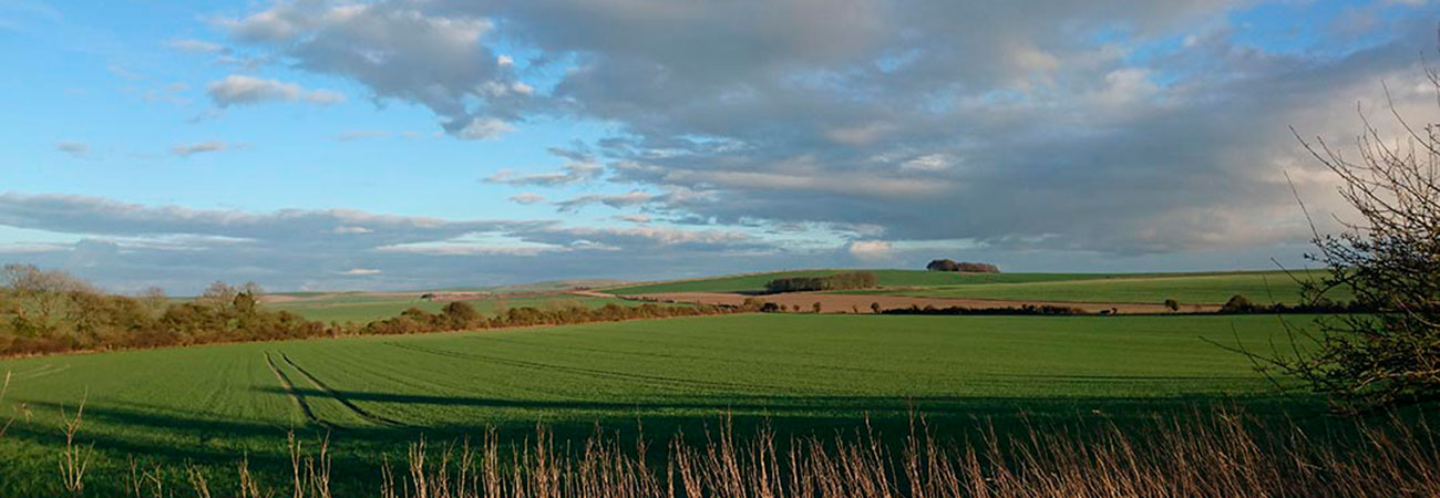
The village lies at the Western scarp of the Marlborough Downs. The highest point of the parish is the summit of King’s Play hill which stands at 230 m. The name King’s Play refers to the Battle (and Royalist victory) on Roundway Down in 1643. There are several barrows on King’s Play Hill including a Neolithic long barrow and a bowl barrow containing a Saxon burial. Roman remains have been found at Heddington Wick and elsewhere in the west part of the parish. King’s Play is also a site of Special Scientific Interest.
Notable Landmarks, Areas, Trails, and Buildings
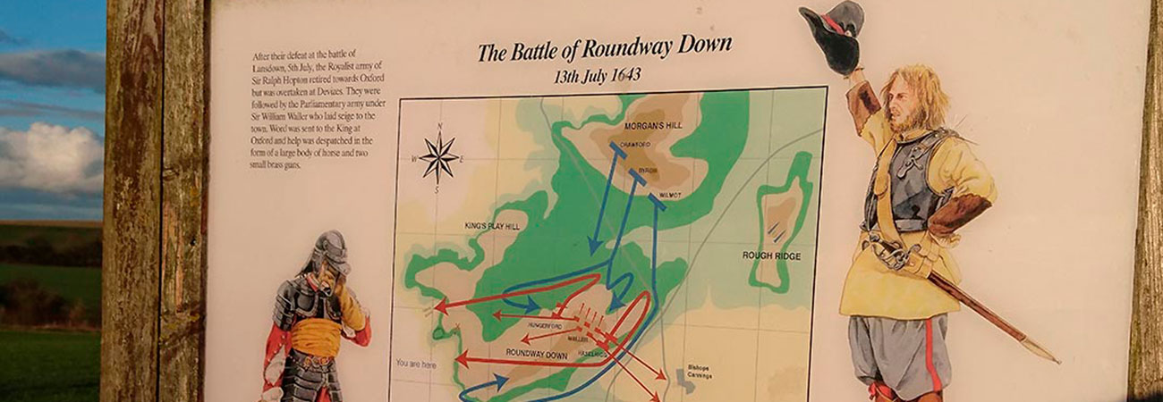
Roundway Down and Olivers Castle
In the midst of the English Civil War a battle was fought on Roundway Down in July 1643. The Roundhead forces mustered at the Celtic Hillfort now known as Oliver’s Castle, and the Royalist forces, largely mounted, gathered together at Morgan’s Hill. Despite having greater numbers, the Roundhead forces were routed and driven back to a gully near Oliver’s Castle which is now known as “Bloody Ditch”. It’s rated by some as the most comprehensive Royalist victory of the war.
King’s Play Hill Long and Round Barrows
Kings Play Long Barrow and Round Barrow are two of the multitude of barrows and megaliths in the area. There are many more between Heddington and Avebury and in the surrounding area.
Morgan’s Hill
Morgan’s Hill is a site of special scientific interest and a nature reserve of the Wiltshire Wildlife Trust known for its orchids, butterflies and wildflowers.
The hill’s use for radio communications dates back to 1913. It was used by the Royal Engineers during the first world war.
At Morgan’s Hill the Wansdyke, Roman Road, Mid Wilts Way, Wessex Ridgeway, and White Horse Trail meet.
White Horses
There are two of the Wiltshire chalk White Horses close to The Ivy Inn.
The Devizes White Horse is the most recent of the horses carved in celebration of the Millennium in 1999. It is the only chalk horse in Wiltshire to be facing to the right.
The Cherhill White Horse is the second oldest White Horse. Cut in 1780, it was possibly inspired by Wiltshire’s oldest White Horse at Westbury. In turn, the Cherhill Horse inspired the design of the Alton Barnes White Horse. Today, the Cherhill White Horse is maintained by a group of volunteers who weed and re-chalk the figure every couple of years.
The White Horse Trail is a 94-mile walking route that takes in all eight of Wiltshire’s White Horses.
Lansdowne Monument
Located above the Cherhill White Horse is the Lansdowne Monument. Also known as the Cherhill Monument, it is a Grade II listed, 38-metre (125 foot) stone obelisk erected in 1845 by Henry Petty-Fitzmaurice, the 3rd Marquis of Lansdowne to the designs of Sir Charles Barry to commemorate his ancestor, Sir William Petty (1623–1687). The Monument stands at the edge of the earthworks of Oldbury Castle, an Iron Age hillfort.
Sir William Petty was a founding member of the Royal Society and the founder of the Lansdowne family fortune.
St Andrews Church, Heddington
The village church was first mentioned in records in 1130. It was administered by Lacock Abbey. The church was rebuilt in the 13th Century and modified significantly over the next two hundred years, and greatly altered in the 17th Century. It was dedicated to St Andrew in 1491, and the oldest bell in the tower dates back to 1553.
Trails Ancient and Modern
The route of the Bath to London Coach Road around Heddington
In the 17th and 18th centuries when travelling by coach, main routes across the country avoided the marshy and muddy conditions of valleys.
Until the late 18th century the Bath to London coach road ran along the southern boundary of Heddington from Sandy Lane, up Heddington Steps to Beacon Hill then via King’s Play and Shepherd’s Shore to join what was the Bristol to London coach road at Beckhampton.
This part of the coach road was turnpiked in 1713 with tolls being taken at the toll house at what is now locally called ‘Turnpike’. Part of the north-south course of the coach road was apparently altered around 1713 at Turnpike to go via Hitchin Lane to force Calne – Devizes traffic to pass through the turnpike gate. If you follow the route via Hitchen Lane, you can still see cobblestones close to the Quaker burial ground.
Notable travellers along the coach road included Samuel Pepys and Queen Anne of Denmark, wife of King James I. They would have broken their journeys at the Bear Inn, now Bear House, on the outskirts of Heddington. Coachmen and servants stayed at the Bell Inn, now Bell Farm.
There are many milestones along the whole course of the Bath to London Coach road that survive to this day. The ones closest to Heddington at Beacon Hill and then between Kings Play and the Golf Course are arguably the simplest in design but probably amongst the least legible. This one is next to Beacon Hill.
The local section of the coach road declined in importance from the mid 18th century, when London-Bath traffic began to use the improved Bristol road through Calne. It was ‘disturnpiked’ in 1790.
Wansdyke
The Wansdyke (from Woden’s Dyke) is a series of early medieval defensive linear earthworks running between Savernake Forest to Maes Knoll in Somerset. It consists of a ditch and a running embankment from the ditch spoil. The ditch is on the north side, so Wansdyke may have been intended by the Romano-Britons as a defence against West Saxons encroaching from the upper Thames Valley westward.
The eastern portion of the Wansdyke starts at Morgan’s Hill. It is more clearly traceable than the western part. In places the bank is up to 4 m (13 ft) high and the ditch as much as 2.5 m (8.2 ft) deep.
To the West there are parts that run through Spye Park, as it converges on Sandy Lane, once the small Roman town (station) of Verlucio.
Roman Road
The route of the Silchester to Bath roman road passes just north of The Ivy Inn. It connected Calleva Atrebatum (Silchester) with Aquae Sulis (Bath) via Spinae (Speen), Cunetio (near Marlborough) and the roman town of Verlucio (near Sandy Lane). The road was a significant route for east–west travel and military logistics in south-east England during the 1st to 5th centuries.
Wessex Ridgeway
The Wessex Ridgeway is a long-distance footpath running 136 miles from the end of the Ridgeway National Trail at Overton near Avebury to Lyme Regis in Dorset. The footpath was opened in 1994.
Mid Wilts Way
The Mid Wilts Way is a long distance walk of 68 miles in rural Wiltshire which runs east-west across the county from Ham to Mere.